City of Garden Grove GeoNode Extension Development
A map store extension was developed for the CIty of Garden Grove to integrate their L.A.N.D system with GeoNode.
Description
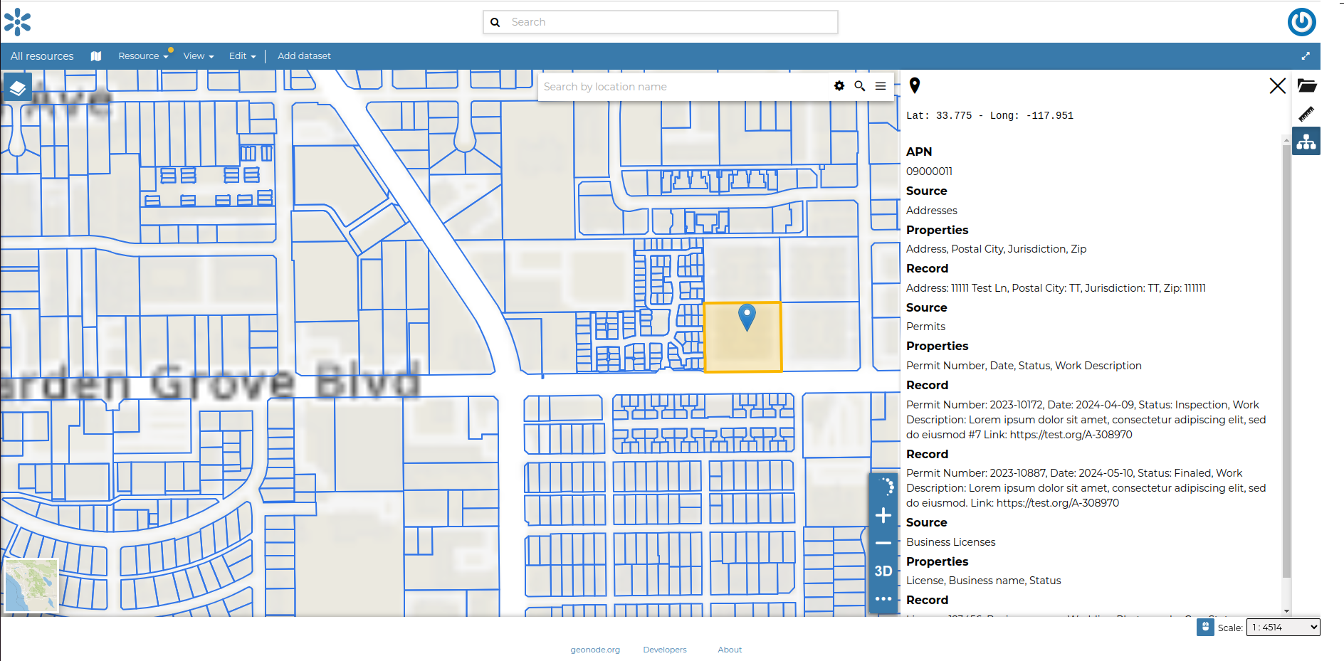
The City of Garden Grove sought to extend their GeoNode instance by integrating it with their L.A.N.D. (Land Asset Navigation Database) system. The project’s goal was to enable users to view an interactive cadastral layer directly in GeoNode, where selecting a parcel on the map triggers a REST API call to retrieve detailed information about the selected cadastre. This information is neatly formatted and displayed in GeoNode through an easy-to-use side panel.
We developed a custom MapStore plugin to handle all the logic required to overlay the cadastral data on any map, make it interactive, query the database with the correct parameters, and display, or share the resulting information.
Services Provided
- Development
Completed: 2024-11-18


