Netstar - Density Map
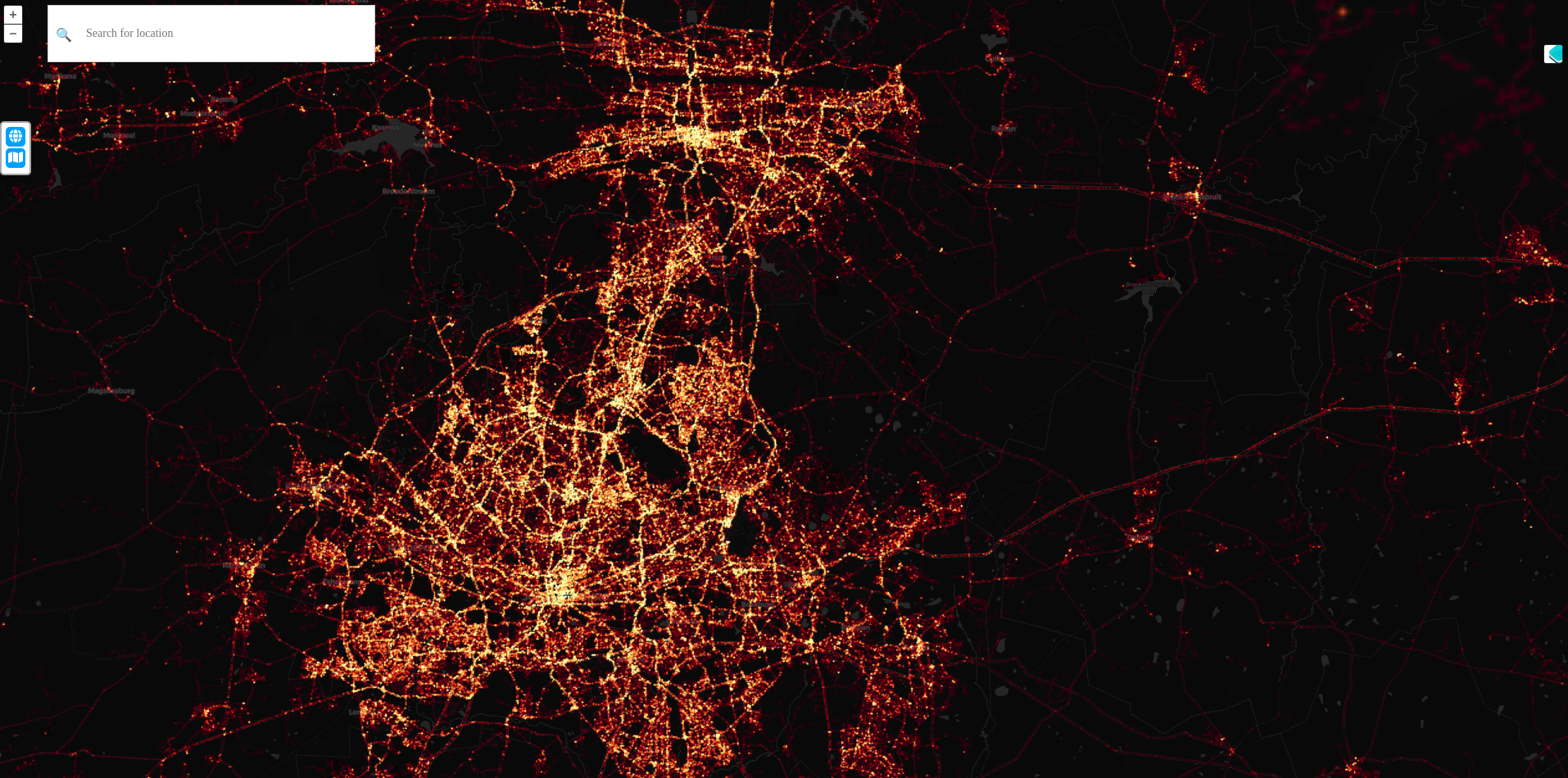
The Density Maps platform enables users to visualize and analyze the growth of new vehicle tracking products over time through interactive heat maps and dynamic filtering options.
Description
Kartoza was contracted by GeoInt to develop the Density Maps platform as a proof-of-concept tool designed to visualize the growth of newly introduced vehicle tracing products over time. Utilizing OpenLayers for visualization and Uber's H3 hexagonal grids for data aggregation, the platform ingests parquet-format data from an Amazon Blobstore into a PostgreSQL database. It generates dynamic views with pg_tileserv at multiple zoom levels, displaying information as a heat map. Users can filter and search data across various time series—days, weeks, or months—enhancing their ability to track product performance and growth effectively.
Services Provided
- Consulting
- Development
- Training
Completed: 2024-07-31


